

Yesterday’s winds blew White Rock Lake wildfire towards Okanagan Indian Band land, but heavy smoke prevented accurate detection.
Yesterday’s clearer conditions allowed BC Wildfire Services to detect fire perimeters better. Last night, the fire erupted on approximately 32,500 hectares. It is located about 8.5 km west of Westside Road.
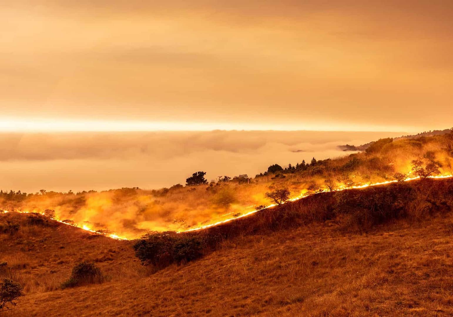
The smoke level dropped, which allowed aircraft to join firefighting efforts.
“Currently, the trajectory of fire has continued along the ridge between Whiteman Main & Bouleau Road,” Okanagan Indian Band reported at 6:30 p.m. Noting that more precise mapping will be available to show the fire’s location, they said.
“Structural Protection Teams have spent all day setting up mass water delivery systems and are ready to respond to any protection actions that may be required.”
The evacuation zone still has Westside Road closed to northbound traffic. DriveBC states that this area is located between Pinecrest Road and Six Mile Creek Roads for 8.4km. It is not known when the road will reopen.
OKIB stated that the closure allows BC Wildfire crews access to fire suppression systems.
“The road closure is likely to continue for the duration of the evacuation order time period.”
BCWS stated that the benefits of the previous rainfall have ended and temperatures will reach the mid-30s with humidity.
BCWS stated that wind forecasts could impact fire activity as early as Thursday afternoon.
Alerts are still in force for 544 properties in Central Okanagan (RDCO), 85 properties in the Thompson-Nicola Regional District and 10 in Columbia-Shuswap Regional District, and 32 in the Regional District of North Okanagan. They also apply below the Whiteman Creek drainage, Parker Cove, Whiteman subdivisions, and OKIB land. Alerts are still in force for thousands more.
To aid evacuees, the IPE grounds have been opened by Spallumcheen and Armstrong.
For the next four to six weeks, a temporary camp will be established at Kin Race Track in Vernon. It will house 200-plus provincial firefighters and support staff. The public is asked to respect privacy and use municipal facilities for recreation.
“The City of Vernon is pleased to welcome BC Wildfire Service into our community and would like to express gratitude to all firefighters and support staff who tirelessly work across the province to respond to wildfire activity taking place,” reads a statement from city officials.
O’Kefe Ranch in Spallumcheen is now open to campers who have their own equipment. The North Okanagan Therapeutic Riding Association also offers space for evacuated animals. If you have valid evacuee paperwork, and your camping gear, the O’Keefe Ranch can be reached at 250-542-7868. You can also reach them on Facebook. Anyone in need of NOTRA’s facilities due to wildfire evacuation orders can contact 250-549-0105 or by email at notra1984@gmail.com.
The fire is being attended by eleven helicopters, 10 risk tree assessors, and 136 firefighters. 43 pieces of heavy machinery, 14 support staff, and 43 helicopters are also available.
Over 100 structure protection officers from 25 fire departments are available to protect properties in Westwold and Falkland, Cedar Hills, and Pinaus Lake 24-7.